|
|
|
HOME
The Degree Confluence Project
Confluence file for South Africa in OziExplorer format
This map shows all documented confluences in South Africa (Red Dot)
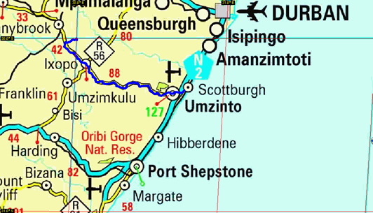
I started my trip at the Umkomaas river mouth where we've been jetskiing the whole morning. After traveling through the town of Umkomaas, I followed the N2 south to the Umzinto turn of. From there I travelled north west through rolling hills of sugar cane and local huts.
The sugar cane gave way to pine forests belonging to the local paper mills. After passing through Ixopo I stopped to ask one of the locals directions as the map I had with me didnt have too musch detail. He directed me to turn around and go back about 10 kilometers, but trusting my Etrex Summit I pushed on and landed on a little dirt road.
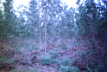
After following the dirt road for a while I reached the general area of the confluence and realised it was smack in the middle of a little wooded area. I carried on on foot and finaly hit the spot (or to within 5 meters if my GPS is to be trusted). Not being able to take any decent pictures in the thicket I went back to the road and took a picture there (S29.998910 E30.000175 Elev. 1296m).
 |
This was 106.6 meters from the confluence.
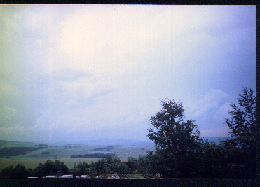
I took another picture just a little way from there to show the general view from the confluence downhillbut this was about 600 meters away.
 |
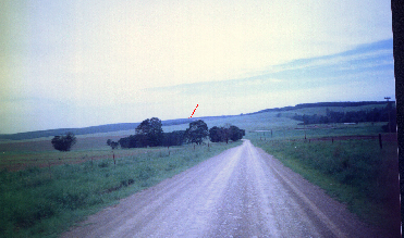
The last picture was taken on the way back to show the area of the confluence on the approaching route (marked in red).
 |
All in all it was a wonderfull trip through the hills of Kwazulu Natal, the type of view you wont find anywhere except in Africa.
 |